一覧を見る

熊本県と宮崎県に接する大分県の南西部。
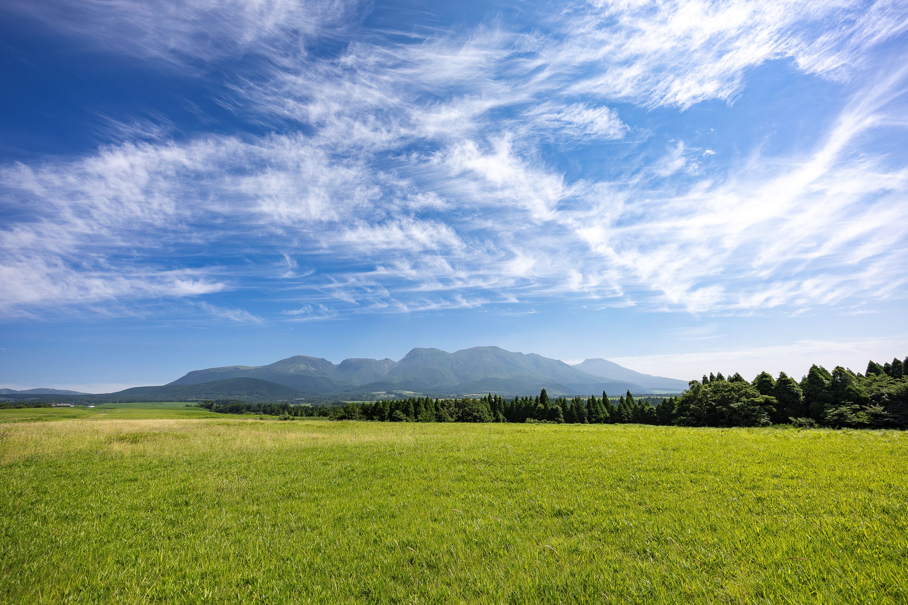
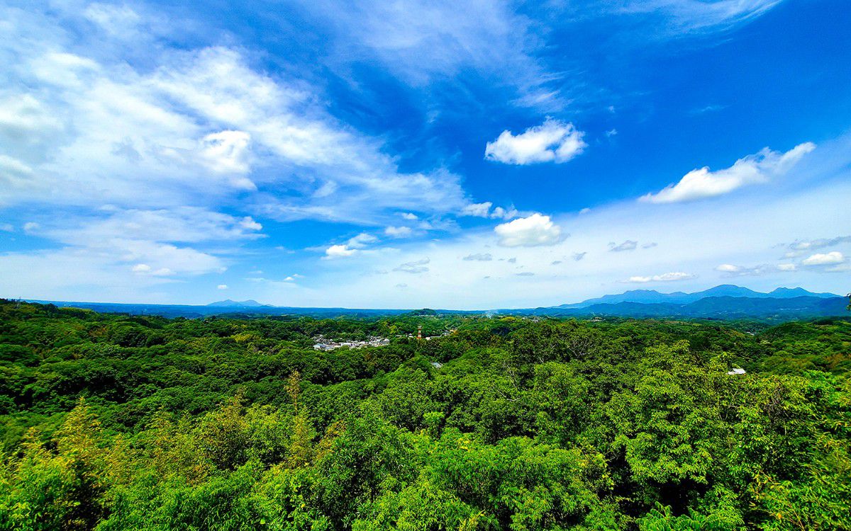
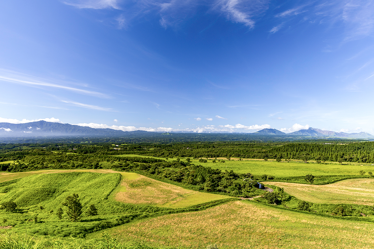
九州の中央に位置する「阿蘇くじゅう国立公園」内の くじゅう連山や、その麓に広がる久住高原、ユネスコエコパークに選定された祖母山など、雄大な自然に囲まれた地域です。

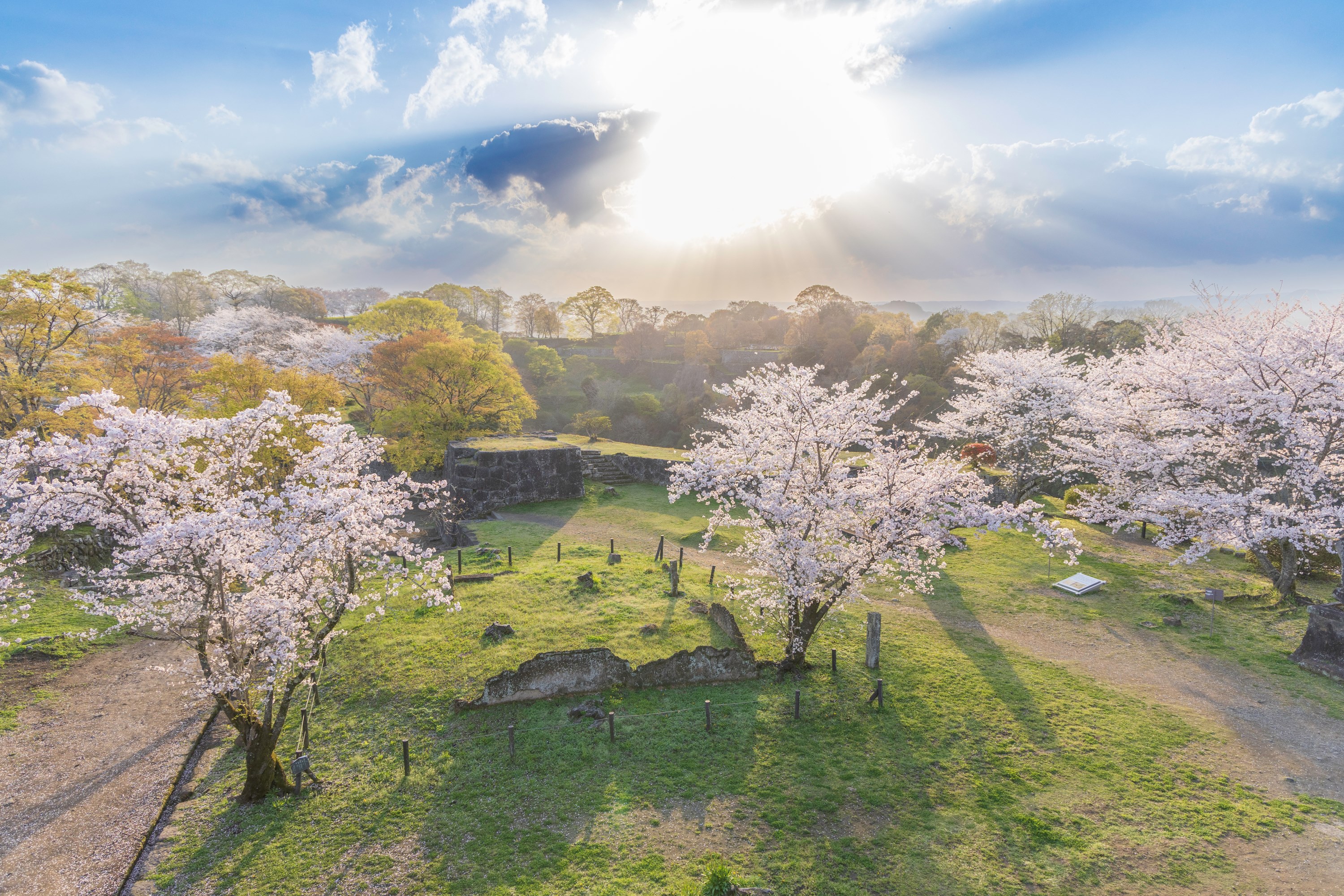
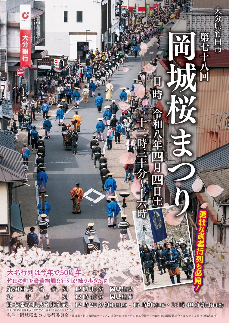
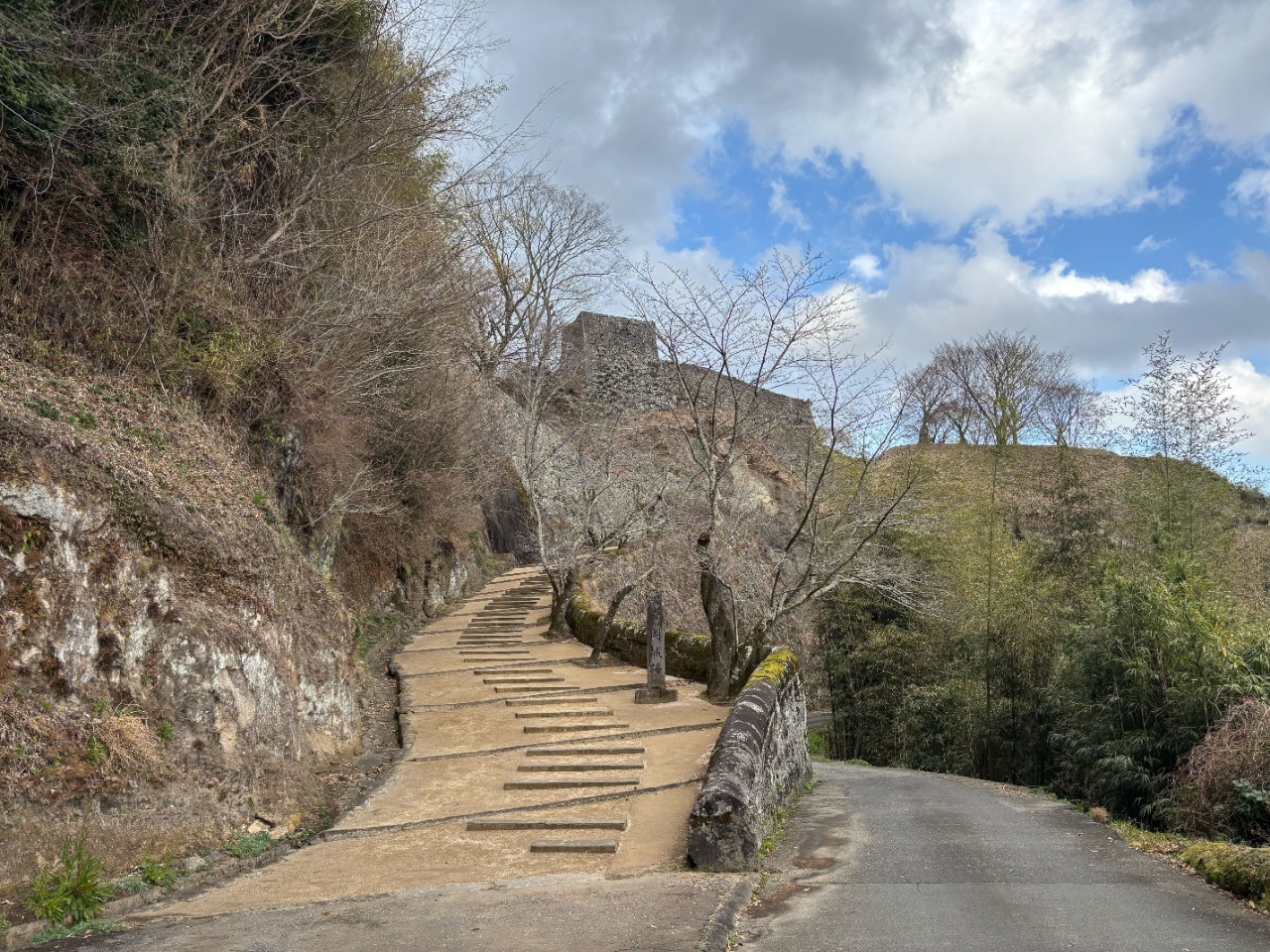
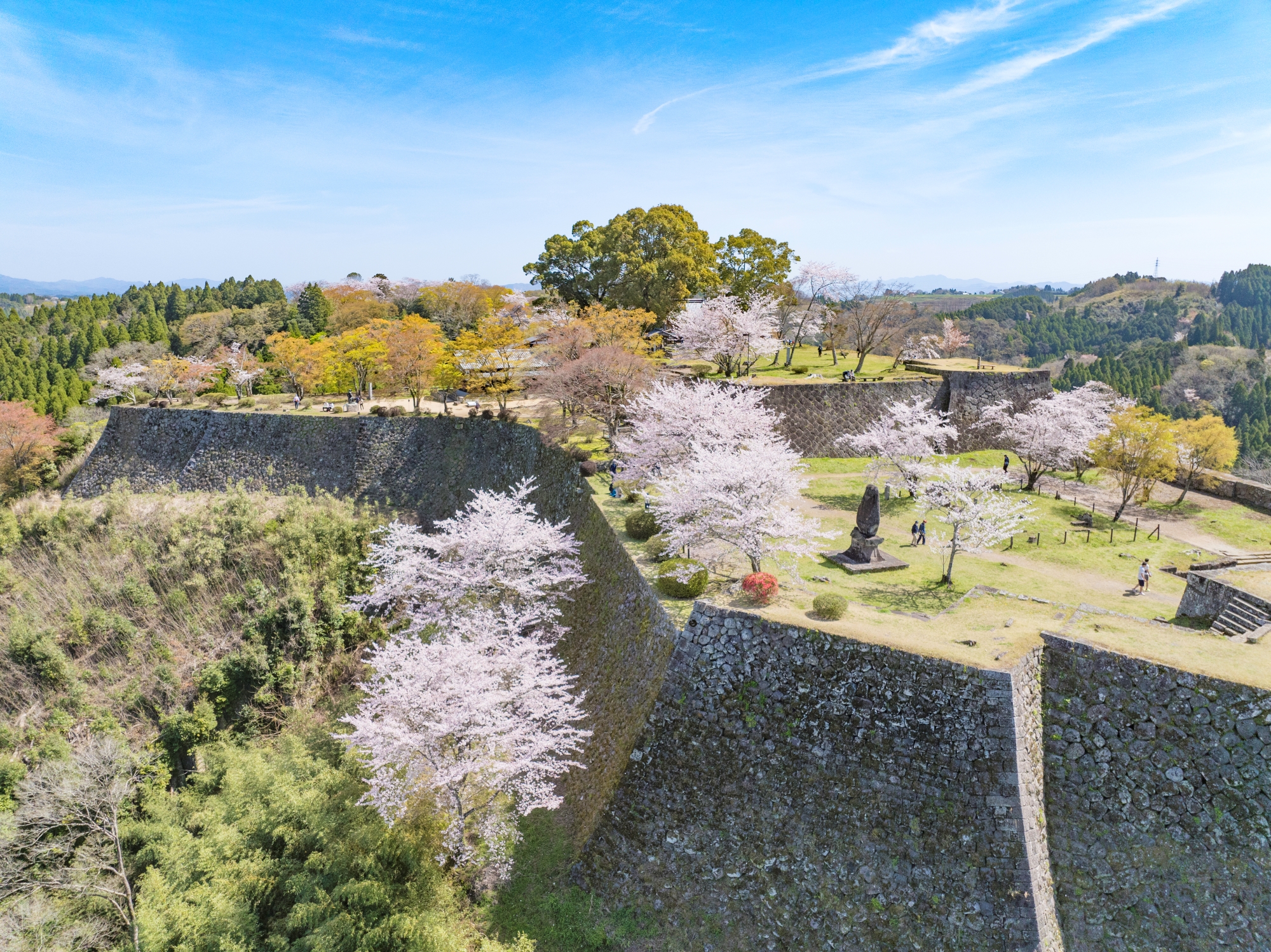
市内中心部には日本百名城の一つ、国指定史跡 岡城跡があり、その眼下には武家屋敷通りなど城下町が古の面影を残します。

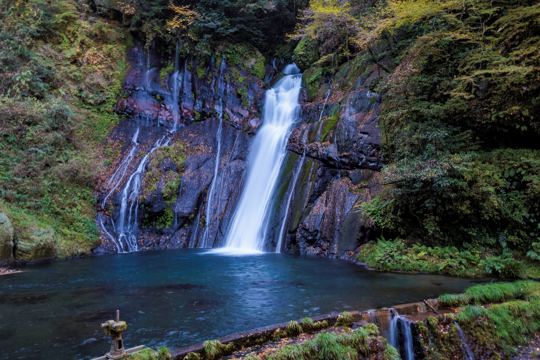
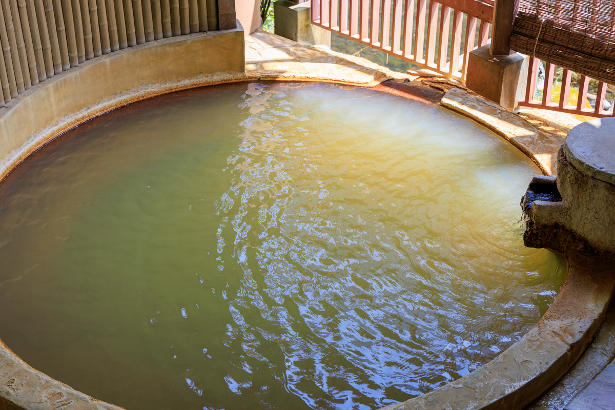
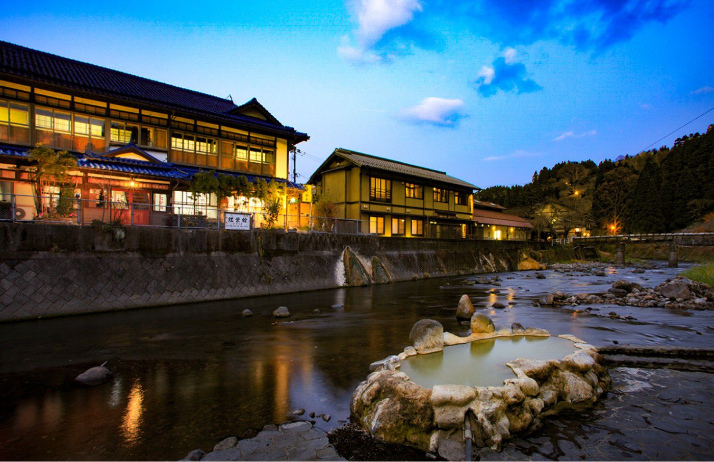
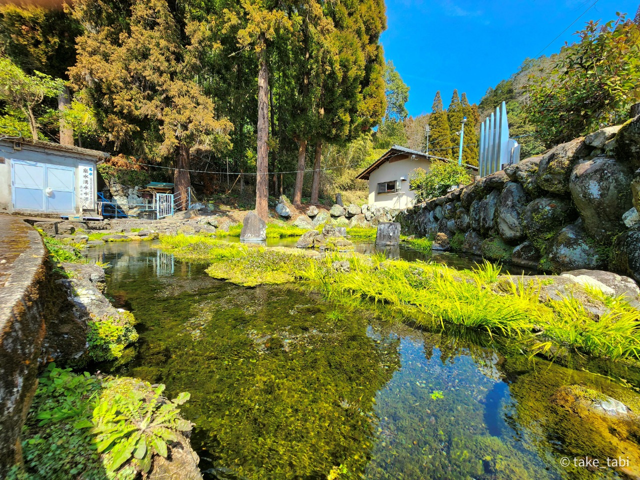
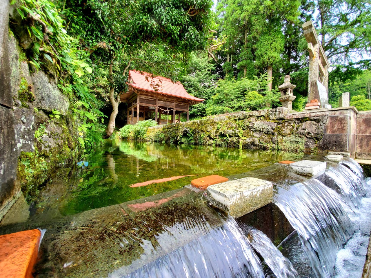
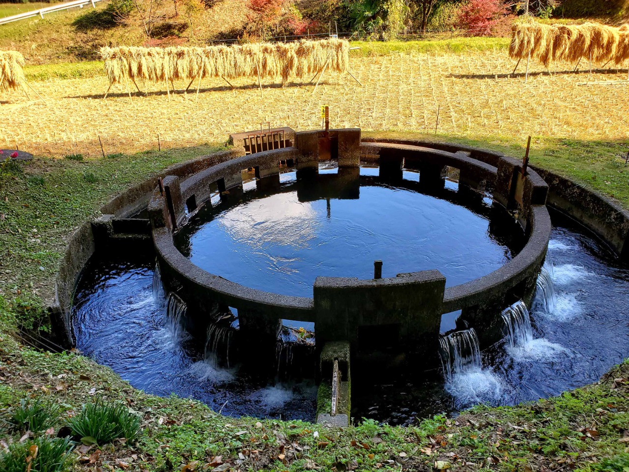
世界有数の炭酸泉と称される長湯温泉をはじめ、市内にはいくつかの泉質が違う温泉や、日本名水百選に選ばれた竹田湧水群も湧出しています。

自然、歴史、文化、温泉、湧水…魅力がつまったこのまちで、
あなただけの竹田を旅してみませんか?

  • 観光スポット温泉
  • 観光スポット宿泊
  • 観光スポットグルメ
  • 観光スポットお土産

自然・歴史・文化にふれる

鎌倉時代初期の緒方三郎(さぶろう)惟(これ)栄(よし)が、源義経を匿うために築城したと云われる岡城。本丸跡からは、くじゅう連山、阿蘇山、祖母山などの山々が一望でき、難攻不落と呼ばれた岡城の800年にも及ぶ歴史が感じられます。

詳細をみる

温泉・泊まる

世界的にも珍しい炭酸泉が湧く長湯温泉をはじめ、市内各所に幾つもの温泉が点在しています。ストレスを和らげ、自然治癒力を高める温泉の効能を体感してください。

詳細をみる

食べる・買う

自然豊かな竹田ならではの旬の食材や名水を使った、大地の恵みを感じる味覚や特産品に出逢います。

詳細をみる

水巡り(たけた編)

城下町・竹田エリア

水巡り

もっとみる

泉水湧水(竹田湧水群)の写真

水巡り(荻町編)

荻・祖母山麓エリア

水巡り

もっとみる

音無井路円形分水の写真

水巡り(直入編)

長湯温泉エリア

水巡り

もっとみる

小津留湧水の写真

  • 束の間の、梅雨の一休み。

📍久住高原
📷️2023.6.7

A brief break from the rainy season.
📍Kuju Plateau 
📷️June 7, 2023

#竹田市 #Plateau 
#くじゅう連山 #久住高原
#九州の絶景 #sky
#nature #skylovers
#naturephotography 
#splendid_earth
#earth #空 #kujuplateau
#landscape 
#landscapephotography 
#geography 
#geographic 
#beautifuldestinations 
#view
#風景 #take_tabi 
#scenery
#Photographer 
#自然写真
#阿蘇くじゅう国立公園 
#asokujunationalpark

※当インスタグラムの情報を転載、複製、改変等は禁止いたします。

Photo & Text by KOSUKE GOTO
@kosuke_goto48
  • ヒイバチの滝
📍大分県竹田市神原
📷️2023.6.5

神の里、神原(こうばる)。

環境省レッドリスト固体群に登録されている「ニホンカモシカ」や「イワメ」が生息しており、大分県絶滅危惧種の「ウバダケニンジン」「キレンゲショウマ」「ツクシアケボノツツジ」などが生育している祖母山(標高1,765m)。

嫗岳大明神を祀る穴森神社に向かう途中、秘境の滝へ誘われました。

渓谷を流れる清流の音を感じ、精霊に見守られながら森の中を歩いていると、神秘的な「ヒイバチの滝」に辿り着きます。

※駐車場は6台程で道は広くありません。登山の途中や、ハイキングにお勧めです。
※三脚を立てて撮影する場所は、ほぼありません。

Hiibachi Waterfall
📍Kobaru, Taketa City, Oita Prefecture
📷️2023.6.5

Kobaru, the village of the Nature God.

Mt.Sobo (1,765 m above sea level), where the Japanese serow and Iwame(fish), both on the Ministry of the Environment's Red List of Solid Groups, live, and where the Ubadake-Ninjin, Kirengeshouma, and Tsukushiakebono azalea, endangered species in Oita Prefecture, grow.

On the way to Anamori Shrine, which enshrines Ubadake Daimyojin, a god of the mountain, you will be invited to a unexplored waterfall.

Walking through the forest, feeling the sound of the clear stream flowing through the valley and being watched over by spirits, you will reach the mysterious Hiibachi Waterfall.

*There are about six parking spaces, but the path is not wide. Recommended for hikers or on the way to the top of the mountain.
*There is almost no place to set up a tripod to take photos.

#祖母山
#ヒイバチの滝
#神原
#ユネスコエコパーク
#神原渓谷
#gorge 
#祖母山
#photographer
#scenery 
#landscape 
#絶景
#valley 
#view
#自然写真
#風景写真 
#nature
#naturelover
#竹田市 
#waterfalls
#taketa #滝
#japanphotography #Traveljapan  #tripjapan  #beautifuldestinations #take_tabi
#naturelovers
#photographer 
#discover_japan 
#visitjapan

Photo & Text by KOSUKE GOTO
@kosuke_goto48

当インスタグラムの情報を転載、複製、改変等は禁止いたします。
  • 今日は、くじゅう山開きの日。

くじゅう連山は標高1791mの中岳や、大船山、久住山など標高1700m級の山々が連なる「九州の屋根」。

いよいよ、本格的に山登りシーズンが始まります。

その「くじゅう連山」の南麓、標高約600~1100メートルの地域に広がる久住高原の風景をお届けします。

1枚目: 📍くじゅう連山
📷️2023.6.4
2枚目:📍 久住町の田園風景
📷️2023.6.3
3枚目:📍 納池公園
📷️2023.6.3

Today is the Kuju mountain-opening day.

Kuju mountain range is the "Roof of Kyushu Island" with Mt.Nakadake at an elevation of 1,791 meters and a series of 1,700-meter-high mountains.

The climbing season in the Kuju mountain range has begun in earnest.

We will share you the beautiful scenery of the southern foot of the "Kuju Mountain Range" stretches from about 600 to 1,100 meters above sea level.

1:📍 Kuju Mountain Range
📷️2023.6.4

2: 📍Rural landscape of Kuju Town
📷️2023.6.3

3: 📍Noike Park
📷️2023.6.3

#竹田市 #taketa
#take_tabi #山 #hike
#hiking #camp #納池公園
#くじゅう連山 #久住高原
#九州の絶景 #大分県の絶景
#nature 
#naturephotography 
#splendid_earth
#earth
#landscape 
#landscapephotography 
#geography 
#geographic 
#beautifuldestinations 
#view
#風景
#scenery
#Photographer 
#自然写真
#阿蘇くじゅう国立公園 
#asokujunationalpark
#Traveljapan

※当インスタグラムの情報を転載、複製、改変等は禁止いたします。

Photo & Text by KOSUKE GOTO
@kosuke_goto48

当インスタグラムの情報を転載、複製、改変等は禁止いたします。
  • 音無井路円形分水「十二号分水」
~水は農家の魂~

📍大分県竹田市九重野
📷️2023.5.27

地域一帯の水田を潤す農業用水路である音無井路。その施設の一部として、1934年(昭和9)に竣工された円形分水。この円形分水まで続く導水区間は、なんと2㎞にも及ぶそうです。円形分水の中心から泉のように湧き出している所が、2㎞続く導水区間の出口になっています。

円形分水ができる昭和初期まで、3つの幹線水路に導入される水の分配で組合員同士が互いに反目し合い騒動を起こし、連日のように水争いが繰り返されていたそうです。
この水争いを収めるために円形分水が造られ、適正な水の分配ができるようになりました。人々の知恵と想いの結晶ともいえる水利施設。

大切に繋いでいきたい、地域の宝です。

”Enkei-bunsui”
Otonashi-Iro Circular Diversion "No. 12 Diversion" 
- Water is the soul of the farmer‐

📍Kujyuno Taketa City Oita Pre. Japan
📷️May 27, 2023

Construction was completed in 1934 as part of the Otonashi-Iro facilities, an agricultural irrigation canal that enriches the rice paddies in the region. The water conduit section leading up to the circular diversion is said to be as long as 2 km. The outlet of the 2-kilometer-long water conduit section is located at the center of the circular diversion, where it gushes out like a spring.

Until the circular diversion was built in the early Showa period (1926-1989), union members were fighting each other over the distribution of water to the three main canals, causing disturbances, and water disputes were repeated every day.
In order to settle this water dispute, a circular diversion was built, which enabled the proper distribution of water. These water facilities are the crystallization of people's wisdom and thoughts.
It is a local treasure that should be carefully preserved.

#農業用水路 #円形分水
#竹田市
#音無井路十二号円形分水
#farm #農業 #水 #水田
#nature 
#naturephotography 
#splendid_earth
#earth
#landscape 
#landscapephotography
#beautifuldestinations 
#view
#風景
#自然
#たけ旅 #taketa
#scenery
#japan_of_insta 
#photographer 
#amazingplaces 
#japanphotography #Traveljapan  #tripjapan 
#take_tabi
#discover_japan 
#visitjapan

※当インスタグラムの情報を転載、複製、改変等は禁止いたします。

Photo & Text by @kosuke_goto48
  • 白水の滝(しらみずのたき)
📷️2023.5.27

水量の少ない白水の滝。珍しい風景でした。

大野川の源流で、滝の高さは38メートル。
岩の間から流れ出る美しい湧水が特徴的です。
かつては約100メートルにわたって湧水が飛び散り白く輝いたと伝えられています。

岡藩主の中川氏も御茶屋を建て清遊したと伝えられており、多くの文化人が訪れ歌を詠み、白水の滝を讃えたと言われています。
 
名水茶屋駐車場(無料)より川沿いの遊歩道を進むと、白水の滝遊歩道案内図と登録記念物が建っています。そこから「白水の滝」までは約700メートルで徒歩で25分程かかります。途中急な階段や坂道もございますので気をつけてお進みください。 

駐車場がある名水茶屋は、かつて岡藩主中川公のお茶屋があったと言われる場所で、お土産品や飲料等を販売する棟と食事処を併設しています。豊後牛、地鶏、田楽、エノハの塩焼きなど地元の食材を堪能できます。庭には天然の湧水もあり、乾いたのどを潤します。

Shiramizu-no-Taki Water Falls with low water volume are rare.

The headwaters of the Ono River, the waterfall is 38 meters high.
It is characterized by spring water flowing out from between the rocks.
In the past, the spring water splashed over a distance of about 100 meters and shone white.

It is said that the Nakagawa clan, lords of the Oka clan, built a teahouse here to enjoy the amazing atmosphere, and many cultural figures visited, composed poems, and praised the Waterfall.

From the parking lot of the Meisui-chaya the local cuisine restaurant, follow the riverside promenade to the Shiramizu-no-taki Waterfalls walking trail, where a guide map and registered monument stand.
 From there, it takes about 700 meters to reach the Waterfall on foot in about 25 minutes. There are steep steps and slopes along the way, so please proceed with care. 
Meisui-chaya is said to have once been the teahouse of Lord Nakagawa of the Oka domain. They offer souvenirs and beverages, as well as local cuisine at the restaurant. Visitors can enjoy local produce such as Bungo beef, local chicken, Tofu-dengaku(grilled tofu dressed with sweet miso paste), and grilled Enoha trout. There is also natural spring water in the garden to quench your dry throat.

#falls #waterfall  #滝  #白水の滝
#九州の絶景 #大分県の絶景
#滝めぐり
#nature 
#naturephotography 
#splendid_earth
#earth
#landscape 
#landscapephotography 
#geography 
#geographic 
#beautifuldestinations 
#view
#風景
#scenery
#Photographer 
#自然写真
#たけ旅
#take_tabi
#ツーリング

Photo & Text by KOSUKE GOTO
@kosuke_goto48

当インスタグラムの情報を転載、複製、改変等は禁止いたします。
  • 昨日、道の駅すごうの創業祭が開催され、軽トラ市をはじめ多くの催し物もあり、たくさんの人で賑わいました。
道の駅すごう @michinoeki_sugo
くたみ太鼓 @drum_kutami

ここ菅生(すごう)地域は九州有数のとうもろこし産地🌽
日中と夜間の大きな気温差と、火山灰の土壌が栽培に適した環境を作り出しています。
季節になると、菅生のとうもろこしを求めて市内外から多くの方々がお越しになります。竹田市の夏の風物詩ですね。
(例年、出荷ピークは7月20日から下旬で最終は8月中旬。)

Yesterday, the foundation festival of Roadside Station Sugo was held.
Many events were held, including a light truck market, which attracted many people.

The Sugo area is one of the leading corn-growing areas in Kyushu.
The large temperature difference between daytime and nighttime and the volcanic ash soil create a suitable environment for growing corn.
In season, many people from inside and outside the city come to Sugo in search of Sugo corn. It is a summer tradition in Taketa City.
(Usually, shipments peak from 20 to late July with the last shipment in mid-August.)

#道の駅すごう #道の駅
#竹田市の食材 #竹田の野菜
#食材 #田舎の風景
#地球創世 #sweetcorn
#道の駅巡り #roadsidestation 
#とうもろこし #とうきび
#竹田市 #taketa_japan 
#take_tabi #たけ旅
#beautifulplaces 
#スイートコーン #corn
#新鮮な野菜 #vegetables 
#大分県 #九州 #地域の魅力
#太鼓 #エイサー #道の駅スタンプラリー
#くたみ太鼓 #visitjapanjp #地域文化

Photo & Text by KOSUKE GOTO
@kosuke_goto48

当インスタグラムの情報を転載、複製、改変等は禁止いたします。
  • 黄牛の滝
Ameushi Waterfall
📷️2023.5.25
📍大分県竹田市大字刈小野
(駐車場:竹田市上坂田103-1 )

竹田市上坂田の稲葉ダム下流にある黄牛の滝は、かつて幻の滝と呼ばれていました。滝の落差は約20mで規模こそ大きくはないものの、岩肌の景観と豊かな水量がある見応えのある滝。

滝の源流である稲葉川は久住山から山間部を流れ、神馬川、久住川、大野川などと合流し別府湾に流れ出る一級河川です。
 
【黄牛の滝の由来・伝説】
この滝に住んでいたとされる荒ぶる龍神を鎮めるため、通りすがりの僧の教えに従い、村人たちが滝つぼに黄牛の子どもの頭を投げ入れたところ、すぐに鎮まったと伝えられています。
 
(どうやって行くの?)
1.国道442号線を久住高原方面に向かいます。黄牛の滝・出会いの湯の看板で左折し、そこから699号線を小さい標識に沿って2km進むと滝に到着します。
2. 国道57号線の天神交差点から、県道639号線を白丹(久住)方面に向かい、黄牛の滝・出会いの湯の看板を目印に向かいます。
 
※公共の交通機関では行けません。お車でお越しください。
※足元が悪いのでスニーカー等、歩きやすい靴でお越しください。 

Ameushi Waterfall
📷️2023.5.25
Kariono, Taketa City, Oita Prefecture, Japan.
(Parking: 103-1 Kamisakata, Taketa City)

Ameushi Waterfall, located downstream of Inaba Dam in Kamisakata, Taketa City, was once known as the Phantom Falls. Although not large in scale, with a fall of approximately 20 m, the waterfall is worth seeing for its rocky landscape and abundant water volume.

The Inaba River, the source of the waterfall, is a first-class river that flows from Mt Kuju through the mountains and joins the Kamba, Kuju and Ono Rivers before flowing out into Beppu Bay.
 
"Origin and Legend of the Ameushi Waterfall"
According to legend, the villagers, following the teachings of a passing monk, threw the head of a young yellow cow into the basin of the waterfall to appease a raging dragon god who was said to live there, and it was immediately appeased.
 
 
(How to get there?)
1. Head towards the Kuju Plateau on National Highway 442. Turn left at the sign for 黄牛の滝 and 出会いの湯, then follow the small sign on Route 699 for 2 km to reach the waterfall.
2. Head towards the Kuju Plateau on prefectural road 638 and follow the signs for 黄牛の滝 and 出会いの湯.
 
*It is not accessible by public transport. Please come by car.
*Please wear sneakers or other comfortable walking shoes as the footing is poor.

#黄牛の滝
#滝
#絶景
#geographic 
#falls 
#waterfall 
#waterfalls 
#landscape 
#views 
#ameushi_waterfall 
#自然写真
#風景写真 
#naturephotography
#nature
#naturelover
#竹田市 
#日本の風景 #たけ旅
#taketa #oita #visitjapanjp
#japanphotography #Traveljapan  #tripjapan  #beautifuldestinations #take_tabi
#photographer 
#discover_japan 
#visitjapan

Photo & Text by KOSUKE GOTO
@kosuke_goto48
  • 若宮井路笹無田石拱橋(わかみやいろ ささむたせっこうきょう)📸2023.5.17
📍竹田市大字挾田2296-3

国の登録有形文化財に指定されているこの水路橋は大正時代(1917)に建設され、豊後大野市朝地町の水田を潤す若宮井路の水利施設となっています。長さは59mで、山王橋(竹田市大字飛田川)と同じく工藤虎彦氏の設計。

"Wakamiya-iro-Sasamuta Aqueduct"

This aqueduct, designated as a National Tangible Cultural Property, was built in the Taisho era (1917) and serves as a water facility for the Wakamiya agricultural waterway, which enriches the rice paddies of Asaji town, Bungo-Ono City. It is 59 m long and, like the Sanno Bridge (Oaza Hidagawa, Taketa City), was designed by Torahiko Kudo.

📍2296-3 Hasada Taketa City Oita Pre. Japan

#railway  #鉄道  #撮り鉄 
#鉄道写真 #水利施設
#train  #aqueduct  #電車
#若宮井路笹無田石拱橋
#登録有形文化財  #文化財 
#bridge #culturalheritage
#水の恵み #地域の魅力
#photographer 
#art #architecture #architect 
#アート #建築 #painting 
#painting🎨 #Traveljapan 
#design #beautifuldestinations 
#竹田市 #たけ旅 #take_tabi 
#taketa 

Photo & Text by KOSUKE GOTO
@kosuke_goto48

当インスタグラムの情報を転載、複製、改変等は禁止いたします。
  • うまれかわる旅
  • たけた旅の手帖
  • 祖母・傾・大崩ユネスコエコパーク
  • TAKETAキリシタン謎PROJECT
  • 竹田市
  • 竹田市バス路線総合案内
  • 竹田湯治

福岡

2時間30分

竹田

熊本空港

バス

1時間20分

竹田

大分駅

電車

60分

竹田

宮崎

2時間40分

竹田